Stage by Stage: The Camino de Santiago Francés Route Breakdown
Walking the Camino Francés, One Stage at a Time
The Camino Francés is the most well-known and beloved Camino de Santiago route.
Spanning roughly 780 km (485 miles), it begins in St. Jean Pied de Port, France, and winds its way across northern Spain to the cathedral in Santiago de Compostela.
When I walked the Camino, the idea of nearly 500 miles felt overwhelming.
But breaking the journey into daily stages made it manageable — and gave me something to look forward to each day.
In this guide, I’ll walk you through the traditional 33 stages of the Camino Francés.
Whether you’re a first-time pilgrim or planning a return journey, this breakdown will help you understand:
Average distances
Terrain challenges
Key highlights and towns
Tips for pacing yourself and enjoying the experience
Related Post: 10 Things I Wish I Knew Before Walking the Camino
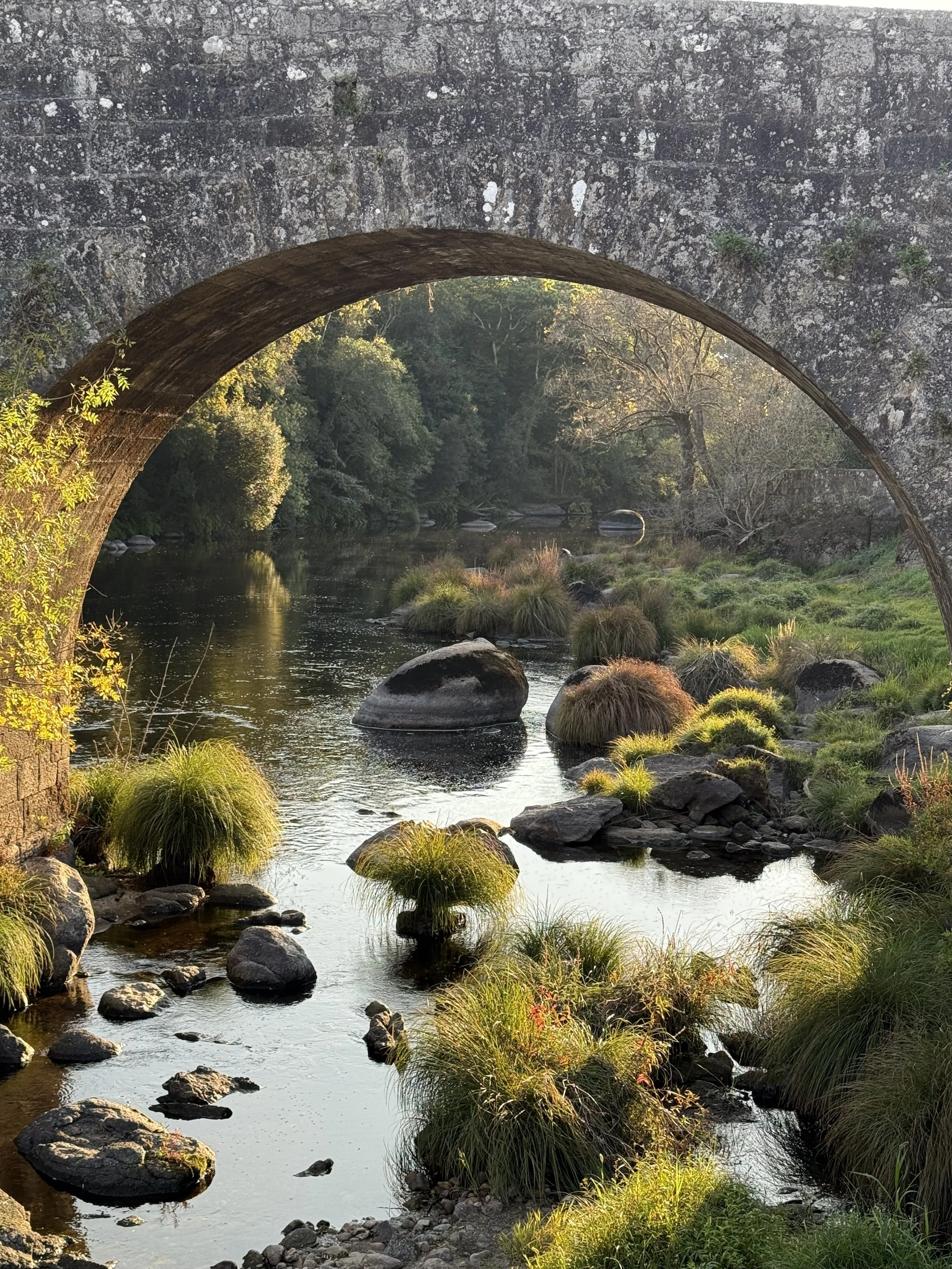
This was one of our favorite spots along the Camino de Santiago, Negeira-A Barca.
Overview of the Camino Francés
Total Distance: 780 km / 485 miles
Typical Duration: 30–35 days walking
Starting Point: St. Jean Pied de Port, France
Ending Point: Santiago de Compostela, Spain
The route passes through four main Spanish regions:
Navarra – Rolling hills and lush landscapes
La Rioja – Vineyards and medieval villages
Castilla y León – The vast Meseta plains and historical cities
Galicia – Green, rainy countryside leading to Santiago
Related Post: The Ultimate Guide to Walking the Camino de Santiago: Tips for First-Time Pilgrims
Stage-by-Stage Breakdown
Here’s the classic 33-day itinerary many pilgrims follow.
Feel free to adjust based on your pace, fitness level, and time available.
We broke down some of the stages, so that our days weren’t as long. We also planned five rest days along the Camino. One of our Camino goals was to slow down and really take it all in.
Stage 1: St. Jean Pied de Port → Roncesvalles
Distance: 25 km / 15.5 miles
Terrain: Challenging — steep ascent over the Pyrenees
Highlights: Stunning mountain views, crossing into Spain, picturesque Roncesvalles monastery
Tip: Start early to avoid afternoon fog and heat. This is one of the toughest stages! Be sure to pack water, snacks and T.P. (Carry a ziploc baggie to carry out any soiled T.P.) There is a long stretch with no services.
This was a very hard day, especially for our first day. However, once we accomplished this stage, we felt like we could accomplish anything.
Stage 2: Roncesvalles → Zubiri
Distance: 21 km / 13 miles
Terrain: Downhill with some rocky, uneven paths
Highlights: Charming medieval bridges, beautiful forests
Stage 3: Zubiri → Pamplona
Distance: 20 km / 12.5 miles
Terrain: Gentle ups and downs
Highlights: Entering Pamplona, famous for the Running of the Bulls, vibrant city atmosphere
Related Post: What to Do in Pamplona as a Pilgrim
Stage 4: Pamplona → Puente la Reina
Distance: 23 km / 14 miles
Terrain: Moderate climbs, including the Alto del Perdón
Highlights: Iconic pilgrim statue, historic medieval bridge at Puente la Reina

Pyrenees Mountains, Camino de Santiago
Stage 5: Puente la Reina → Estella
Distance: 22 km / 13.7 miles
Terrain: Rolling hills through vineyards and olive groves
Highlights: Wine fountain at Irache, charming Estella streets
Stage 6: Estella → Los Arcos
Distance: 21 km / 13 miles
Terrain: Open countryside, limited shade
Highlights: Peaceful farmland and quiet villages
Stage 7: Los Arcos → Logroño
Distance: 28 km / 17 miles
Terrain: Long day with varied terrain
Highlights: Entering La Rioja wine country, Logroño’s lively tapas scene
Stage 8: Logroño → Nájera
Distance: 29 km / 18 miles
Terrain: Gradual uphill sections
Highlights: Vineyards and red clay landscapes
Stage 9: Nájera → Santo Domingo de la Calzada
Distance: 21 km / 13 miles
Terrain: Gentle farmland paths
Highlights: Cathedral with live chickens inside (unique Camino tradition!)
Stage 10: Santo Domingo → Belorado
Distance: 23 km / 14 miles
Terrain: Flat and easy walking
Highlights: Quiet countryside and small villages
Stage 11: Belorado → San Juan de Ortega
Distance: 24 km / 15 miles
Terrain: Steady uphill climb through oak forests
Highlights: Spiritual atmosphere at the San Juan monastery
Stage 12: San Juan de Ortega → Burgos
Distance: 27 km / 16.7 miles
Terrain: Mostly downhill, city approach can be industrial
Highlights: Stunning Burgos Cathedral, rest day opportunity
Stage 13: Burgos → Hornillos del Camino
Distance: 21 km / 13 miles
Terrain: Flat Meseta landscapes
Highlights: Quiet walking and expansive views
Stage 14: Hornillos → Castrojeriz
Distance: 20 km / 12.5 miles
Terrain: Flat and open
Highlights: Medieval ruins and peaceful scenery
Stage 15: Castrojeriz → Frómista
Distance: 25 km / 15.5 miles
Terrain: Steep hill at the start, then flat canal paths
Highlights: Romanesque church in Frómista
Monastery in Carrion de los Condes
Stage 16: Frómista → Carrión de los Condes
Distance: 19 km / 11.8 miles Historic churches and pilgrim traditions
Terrain: Flat, easy walkingHighlights:
Historic churches and pilgrim traditions
FOLLOW THE CAMINO CHRONICLES
Stage 17: Carrión de los Condes → Terradillos de los Templarios
Distance: 26 km / 16 miles
Terrain: Long, isolated stretch — pack plenty of water and snacks
Highlights: Tranquil Meseta experience
Stage 18: Terradillos → Sahagún
Distance: 13 km / 8 miles
Terrain: Easy walking day
Highlights: Great spot for a short stage or rest day
Check out the Gear and Gifts page
Stage 19: Sahagún → El Burgo Ranero
Distance: 17 km / 10.5 miles
Terrain: Straight, flat paths
Highlights: Quiet reflection time
Stage 20: El Burgo Ranero → Mansilla de las Mulas
Distance: 19 km / 11.8 miles
Terrain: Gradual terrain, easy pace
Highlights: Traditional Spanish town with great food options
Stage 21: Mansilla → León
Distance: 18 km / 11 miles
Terrain: Mostly urban approach
Highlights: León Cathedral and tapas streets
Stage 22: León → Villadangos del Páramo
Distance: 22 km / 13.7 miles
Terrain: Easy, flat walking
Highlights: Transitioning back to rural landscapes
Stage 23: Villadangos → Astorga
Distance: 27 km / 16.7 miles
Terrain: Moderate climbs
Highlights: Gaudí-designed Episcopal Palace in Astorga
Stage 24: Astorga → Rabanal del Camino
Distance: 20 km / 12.5 miles
Terrain: Gradual uphill
Highlights: Stunning mountain views
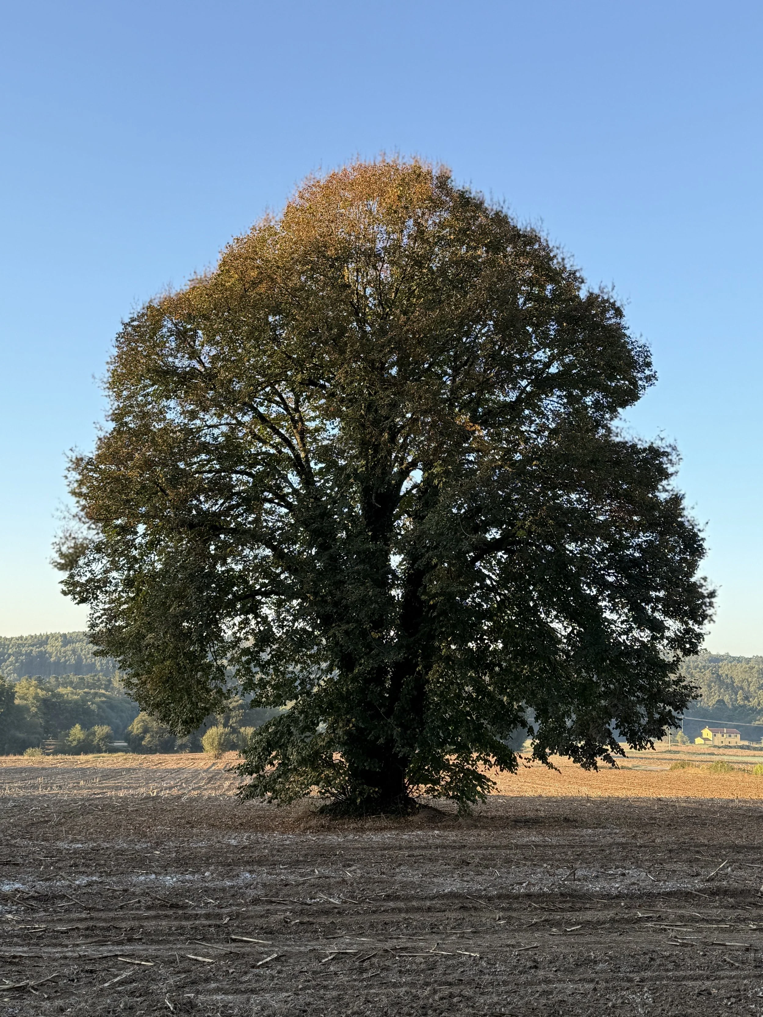
A beautiful Oak tree along the Camino de Santiago trail
Stage 25: Rabanal → Ponferrada
Distance: 32 km / 20 miles
Terrain: Steep uphill and downhill sections — challenging day
Highlights: Iron Cross (Cruz de Ferro), Ponferrada’s Templar Castle
Stage 26: Ponferrada → Villafranca del Bierzo
Distance: 24 km / 15 miles
Terrain: Gentle walking through vineyards
Highlights: Beautiful valley scenery
Stage 27: Villafranca → O Cebreiro
Distance: 28 km / 17 miles
Terrain: Difficult climb into Galicia
Highlights: Traditional stone houses and mountain views
My favorite stretch of the Camino de Santiago is from Villafranca to Samos. It’s stunning!
Stage 28: O Cebreiro → Triacastela
Distance: 21 km / 13 miles
Terrain: Rolling hills, easier than the previous day
Highlights: Misty forests and green landscapes
Stage 29: Triacastela → Sarria
Distance: 18 km / 11 miles
Terrain: Downhill sections through small villages
Highlights: Transition point for pilgrims starting at Sarria
Stage 30: Sarria → Portomarín
Distance: 22 km / 13.7 miles
Terrain: Rolling hills
Highlights: Scenic riverside town
Stage 31: Portomarín → Palas de Rei
Distance: 25 km / 15.5 miles
Terrain: Moderate, mixed terrain
Highlights: Rural Galicia at its finest
Stage 32: Palas de Rei → Arzúa
Distance: 29 km / 18 miles
Terrain: Longer stage but not difficult
Highlights: Dairy farms and peaceful walking
Stage 33: Arzúa → Santiago de Compostela
Distance: 39 km / 24 miles (often split into two days)
Terrain: Mostly rolling hills and wooded paths
Highlights: The emotional arrival at Santiago Cathedral
Related Post: How to Get Your Compostela Certificate
Tips for Pacing Yourself
Start slow: Don’t overdo the first week — your body needs time to adjust.
Take rest days in major cities like Pamplona, Burgos, León, or Sarria.
Listen to your feet: Blisters and shin splints are common signs you need to slow down. (I learned this the hard way and I got huge blisters on day 3.)
Be flexible: You can combine or split stages depending on how you feel.
Final Thoughts: A Journey of Many Steps
Walking the Camino Francés is about so much more than distances and towns.
Each stage brings its own challenges, beauty, and moments of connection.
As you walk toward Santiago, remember that every step is part of your story.
Whether you complete the route in 30 days or 40, the Camino is about the journey, not just the destination.
Call-to-Action
Ready to plan your own pilgrimage?
Download my free Camino Packing Guide to start your journey prepared.
Check out my Camino Route Guide to choose the path that’s perfect for you.
Read my guide on 10 Things I Wish I Knew Before Walking the Camino for tips on preparation.
Follow Camino.Chronicles on Instagram for daily Camino inspiration and updates.
Buen Camino, friends!
Renae